


VTD-precinct Parmelee, Todd County, South Dakota
About
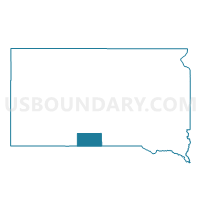
Outline

Summary
| Unique Area Identifier | 667805 |
| Name | VTD-precinct Parmelee |
| County | Todd County |
| State | South Dakota |
| Area (square miles) | 244.32 |
| Land Area (square miles) | 243.56 |
| Water Area (square miles) | 0.76 |
| % of Land Area | 99.69 |
| % of Water Area | 0.31 |
| Latitude of the Internal Point | 43.31263270 |
| Longtitude of the Internal Point | -101.01451380 |
Maps


Graphs
Select a template below for downloading or customizing gragh for VTD-precinct Parmelee, Todd County, South Dakota


Neighbors
Neighoring Voting District (by Name) Neighboring Voting District on the Map
- VTD - Long Valley precinct, Jackson County, SD
- VTD - Vetal, Bennett County, SD
- VTD-precinct 2, Mellette County, SD
- VTD-precinct 6, Mellette County, SD
- VTD-precinct Bordeaux, Todd County, SD
- VTD-precinct Mission City and N.Antelope, Todd County, SD
- VTD-precinct Rosebud, Todd County, SD
- VTD-precinct SouthAntelope, Todd County, SD
- VTD-precinct St.Francis, Todd County, SD
- VTD-Tuthill, Bennett County, SD
Top 10 Neighboring County Subdivision (by Population) Neighboring County Subdivision on the Map
- West Todd UT, Todd County, SD (4,863)
- East Todd UT, Todd County, SD (2,858)
- East Bennett UT, Bennett County, SD (992)
- Central Mellette UT, Mellette County, SD (687)
- Norris township, Mellette County, SD (189)
- Southeast Jackson UT, Jackson County, SD (187)
- Blackpipe township, Mellette County, SD (60)
- Surprise Valley township, Mellette County, SD (25)
- Ring Thunder township, Mellette County, SD (13)
Top 10 Neighboring Place (by Population) Neighboring Place on the Map
Top 10 Neighboring Unified School District (by Population) Neighboring Unified School District on the Map
- Todd County School District 66-1, SD (9,612)
- Bennett County School District 03-1, SD (3,431)
- Kadoka School District 35-2, SD (3,298)
- White River School District 47-1, SD (1,782)
Top 10 Neighboring State Legislative District Lower Chamber (by Population) Neighboring State Legislative District Lower Chamber on the Map
Top 10 Neighboring State Legislative District Upper Chamber (by Population) Neighboring State Legislative District Upper Chamber on the Map
Top 10 Neighboring 111th Congressional District (by Population) Neighboring 111th Congressional District on the Map
Top 10 Neighboring Census Tract (by Population) Neighboring Census Tract on the Map
- Census Tract 9402, Todd County, SD (5,161)
- Census Tract 9401, Todd County, SD (4,451)
- Census Tract 9403, Mellette County, SD (2,048)
- Census Tract 9412, Jackson County, SD (1,813)
- Census Tract 9412, Bennett County, SD (1,812)
Top 10 Neighboring 5-Digit ZIP Code Tabulation Area (by Population) Neighboring 5-Digit ZIP Code Tabulation Area on the Map
- 57555, SD (3,834)
- 57570, SD (2,064)
- 57572, SD (1,847)
- 57579, SD (1,330)
- 57566, SD (1,060)
- 57560, SD (436)
- 57547, SD (139)
- 57574, SD (104)